
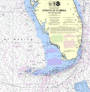
- NOAA Online Chart Viewer
- NOAA Electronic Navigational Charts® (NOAA ENCs)
- Full Resolution Printable NOAA Charts
- NOAA Printable Chart Books, Atlantic Coast
Jersey Shore, Delaware Bay & Delaware River
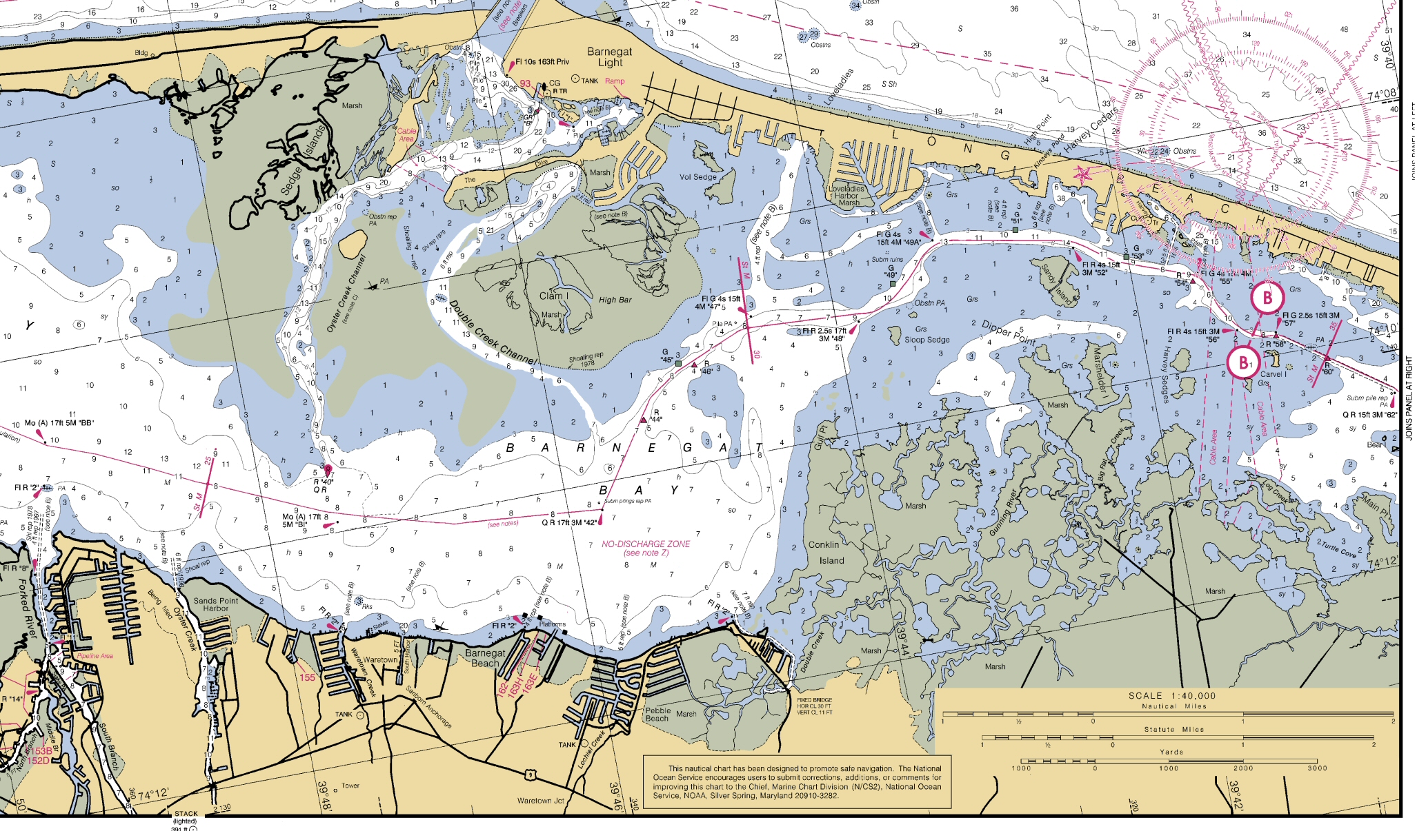
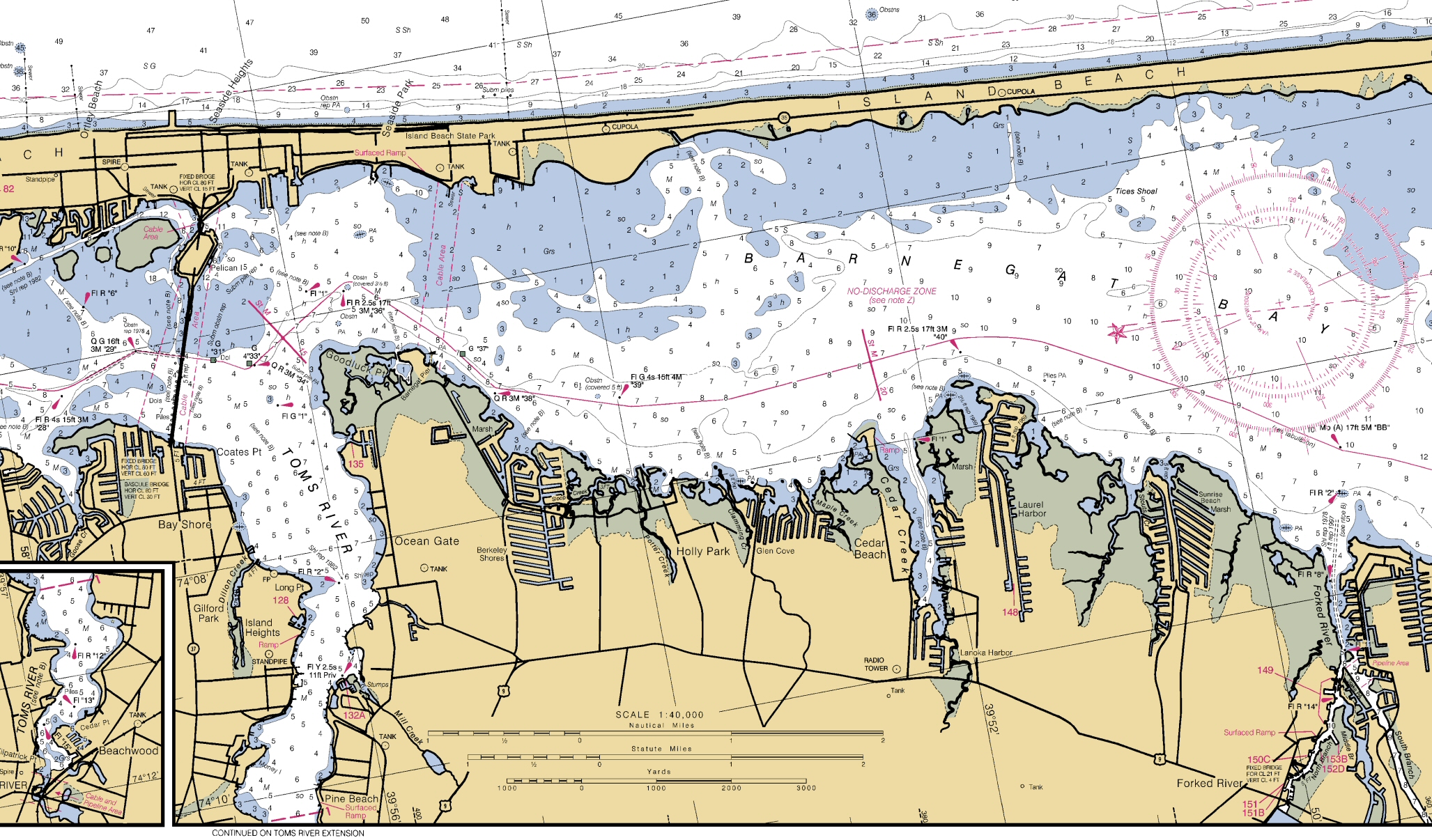
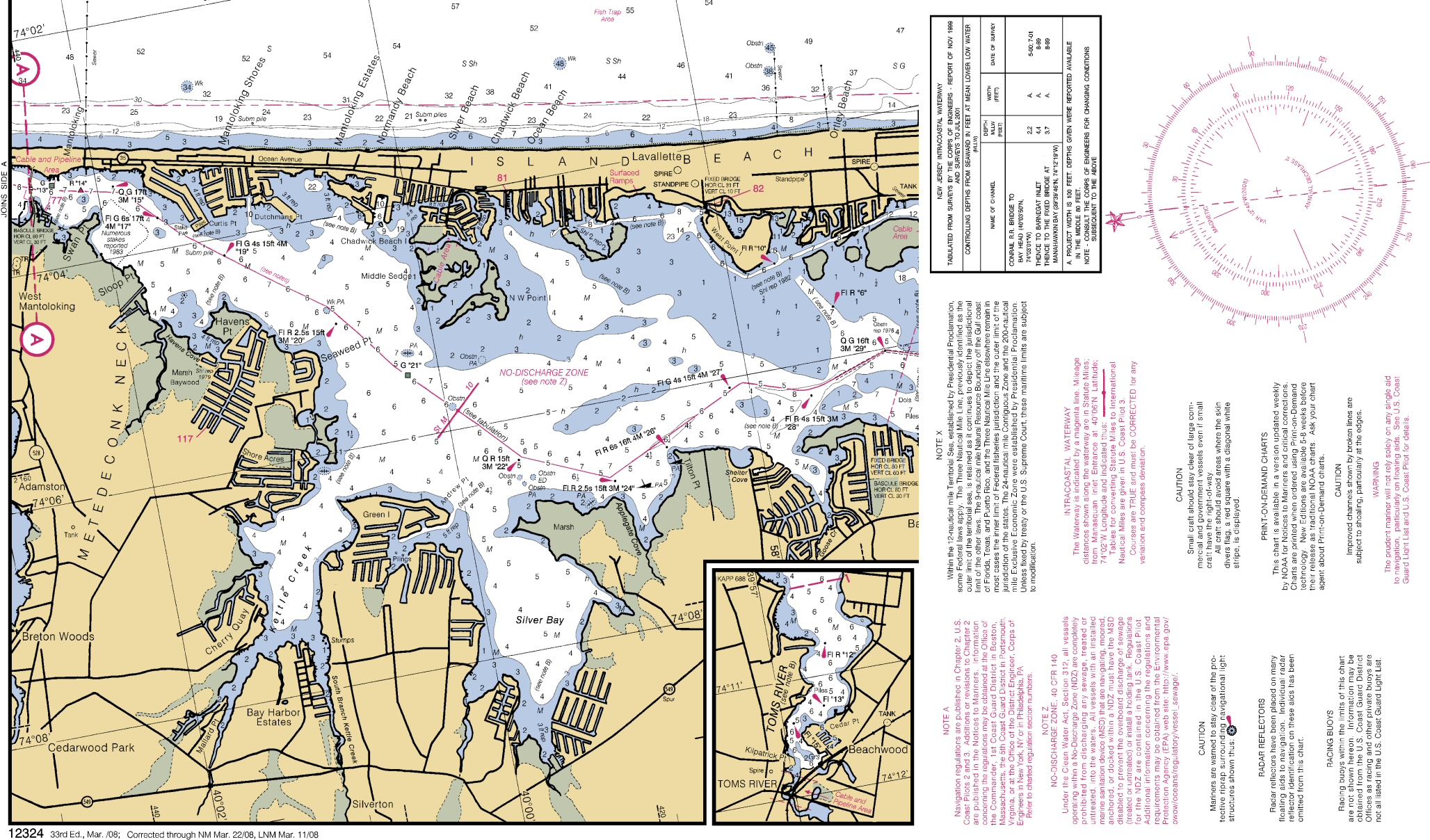
- Chart 12324, Barnagate Bay
- Chart 12316, Little Egg Harbor
- Chart 12323, Sea Girt to Little Egg, Outside Only
- Chart 12317, Detail Cape May Harbor
- Chart 12304, Delaware Bay
- Chart 12277, C&D Canal
- Chart 12311, Delaware River, Smyrna to Wilmington
- Chart 12312, Delaware River, Wilmington to Philadelphia
- Chart 12313, Delaware River, Philadelphia & Camden Waterfront
- Chart 12314, Delaware River, Philadelphia to Trenton
Printable Barnegat Bay Charts (legal size)
 Upper
Chesapeake Bay, C&D Canal
Upper
Chesapeake Bay, C&D Canal
- Chart 12277, C&D Canal
- Chart 12280, Chesapeake Bay (200,000)
- Chart 12273, Chesapeake Bay Sandy Point to Susquehanna River (80,000)
- Chart 12274, Head of Chesapeake Bay (40,000)
- Chart 12272, Chester River; Kent Island Narrows, Rock Hall Harbor and Swan Creek
- Chart 12270, Chesapeake Bay Eastern Bay and South River; Selby Bay
- Chart 12278, Chesapeake Bay Approaches to Baltimore Harbor
- Chart 12282, Chesapeake Bay Severn and Magothy Rivers
- Chart 12281, Baltimore Harbor
- Chart 12283, Annapolis Harbor
- Chart 12284, Patuxent River Solomons lsland and Vicinity
- 2008 Coast Pilot, Atlantic Coast: Sandy Hook, NJ to Cape Henry,VA
- 2008 Notices to Mariners, January thru